GREEN URBANITY
Something’s up.
1.0 CITY SCALE – GREEN AREA SYSTEM OF BUDAPEST
Zugló is viewed as one of the greenest areas, containing the lungs of the city. But the green surface ratio of 14,4 m2 / inhabitant in Budapest is still below EU average (21,0 m2 / inhabitant)1. Making it even greener should be the aim.
The disposition of unbuilt lands in the suburbs of Budapest has the potential of becoming regional parks of a green belt2, while a revitalized Rákos creek could connect the agglomeration in a green corridor all the way to the center of the city.
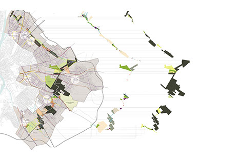
Fig. 1 Green belt study in Budapest2
Rákos creek could be turned into a destination spot for people looking for recreational, sport and even cultural activities while creating a strong local community and identity for this renewed element of the future green network of Budapest.
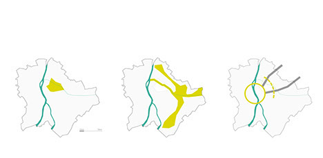
Fig. 2 City scale: Green Zugló - Green belt - Expanding destination
An elementary need is the structural reform–extension, permeability–of the green strip in a way that only the really necessary and consequent interventions are made. The chain reaction initiated by the metaobjects makes this area valuable and livable for local residents.
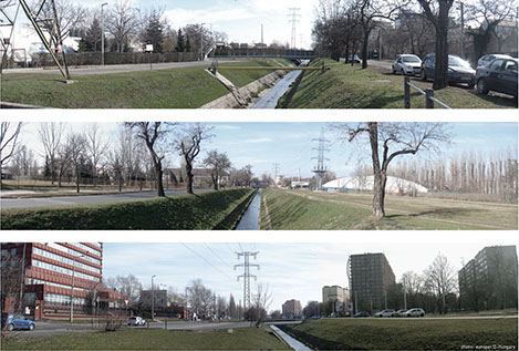
Fig. 3 Existing situation along the creek (photo: EUROPAN12–HUNGARY)
2.0 DISTRICT SCALE – NATURE AND SOCIETY
Both ends of the Zugló section of Rákos creek lie near areas in transition that have the prospect of becoming intermodal nodes in the future. The green ribbon spanning in-between would become an important link for pedestrians and cyclists, while vehicular traffic would be diverted to the boulevard turned old belt-line. By exploring and rationalizing the broader context and network that surround the site, it facilitates to revise the traffic system in the immediate vicinity of the creek.
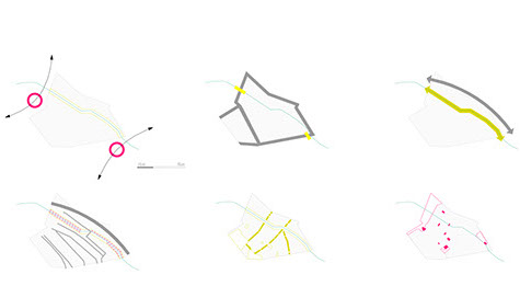
Fig. 4 District level: changing areas | sack | soft-hard parallel | traffic alleviation
green corridors | old industrial facilities
Two-lane roads on both sides of the creek are unnecessary, just like some of the crossings. Considerable extension of the green area becomes possible by minimizing paved surfaces and involving municipally owned adjacent lots. Pedestrian and cycling lanes run on separate sides of the creek, unhindered as much as possible. Alternative functions are dispersed along the walkway, while it also links the creek with the mixed-use lane on the edge of the green strip.
One way for raising value is the revitalization of the creek’s bed. It would mean change not in a formal, but a rather ecological sense. The so called green rooms along the creek would have a sequence of slightly differing vegetational character, giving new identity to the whole area.
3.0 REGENERATION
Metaobjects are sprouting up
Metaobjects placed at strategic locations provide the initial points of intervention. These would be means of communication with a previously missing function also incorporated. Patak Radio, a second layer of PR would broadcast updates and useful information related to the transformation of the creek. At the same time cultural centers, open workshops and community gardening clubs would find their places in old, abandoned industrial buildings with the hope of generating social participation. After a free registration local residents could take part in collective workshops aiming for the transformation of the water banks also by creating their own catalogue objects. Decision about placement and maintenance would be up to the community.
A different vibe is on the air
Each site of the project provides opportunity for different interventions:
A wide zone of high-grown energy grass (Miscanthus spec.)3 would appear in place of the bunch of disused rails at Rákosrendező. The ecosystem of the polluted soil would be restored4, facilitating a long-term sustainable development of the future.
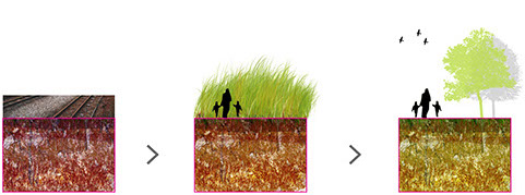
Fig. 5 Process of the soil treatment with Miscanthus spec.
An overpass for pedestrians and cyclists would help crossing over the remaining rails while also linking to the future intermodal node. Also at M3 motorway an underpass parallel with the creek would mean the way of crossing.
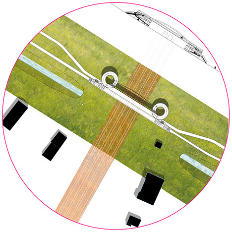
Fig. 6 Crossing boundaries
The old industrial place awakes
Green zone extends in width again, surfaces for sitting are carefully placed, vegetation growing rampant can be witnessed from the converted bridge houses. Traffic gets reduced as roads are relocated and made one-way only. The abandoned aluminium factory turns into a Cultural Center, while two Open Workshops are established next to the creek.
Complementing the future shopping center an urban terrace would be created with cafés and small functions, and improved sport facilities on the other side.
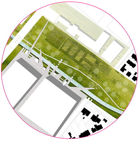
Fig. 7 New center: urban meets nature
Running lane and dog exercise areas are placed next to the creek. Disused high-voltage structures turn into look-out points.
Relying on one-another, sustainable, ecological, abundant... nature and society
By reorganizing the parking and public transport system, and the elimination of the bus turn, a green space with a new quality is born. Climbing wall, bicycle bait, sport fields, community gardens and apiary find their place. Link to the new Community House is established by a new pedestrian bridge.
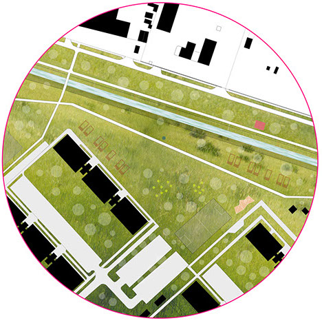
Fig. 8 New Potentials in the nearby housing estate
A seasonal marshland appears at this point with a new ecosystem. Walk- and bikeway leads under the HÉV line next to the creek.
Everybody’s! My creek.
(1) Mielőtt odaláncolod magad - Útmutató a városi zöldfelületek és fák védelméhez
Védegylet füzetek 8. 2006
(2) Green system plan – „Greenway project of Pest” Master thesis of Lilla SZABÓ, 2012
(3) Called Elephant grass, it can grow up to five metres tall.
(4) Pidlisnyuk, V., Erickson, L., Kharchenko, S. and Stefanovska, T. (2014) Sustainable Land
Management: Growing Miscanthus in Soils Contaminated with Heavy Metals. Journal of
Environmental Protection, 5, 723-730.